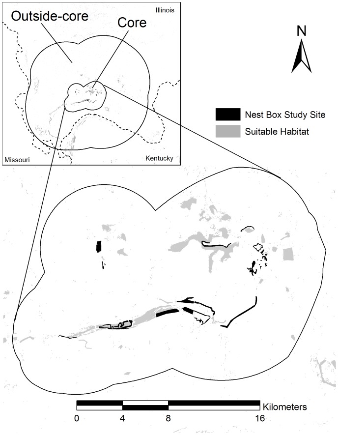
Figure 1. The entire study area depicting suitable habitat (light gray) determined by landcover data (Illinois State Geological Survey; Kentucky Geography Network) aerial photography and extensive surveys throughout the region.
Black patches within core survey area indicate nest box study sites located in the Cache River watershed and dotted lines depict state boundaries.

