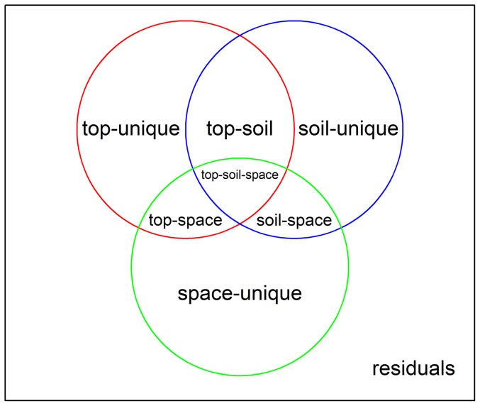
Figure 2. Eight fractions without overlap resulting from variation partitioning using topographic, edaphic and spatial explanatory tables: purely topographic (top-unique), purely edaphic (soil-unique), purely spatial (space-unique), topographically structured edaphic (top-soil), spatially structured edaphic (soil-space), spatially structured topographic (top-space), spatially and topographically structured edaphic (top-soil-space), and unexplained (residuals).
Several interpretable quantities can be calculated by adding up fraction values, for example, top-all ( = [purely topographic]+[topographically structured edaphic]+[spatially structured topographic]+[spatially and topographically structured edaphic]) represents the proportion of total variation explained by topography, soil-all ( = [purely edaphic]+[topographically structured edaphic]+[spatially structured edaphic]+[spatially and topographically structured edaphic]) represents the proportion of total variation explained by soil, and space-all ( = [purely spatial]+[spatially structured edaphic]+[spatially structured topographic]+[spatially and topographically structured edaphic]) represents the importance of spatial variables.

