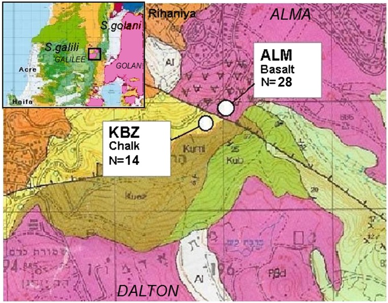
Fig. 1.
Geological map of the studied Dalton region in the Upper East Galilee, Israel. S. galili sampling sites, soil type, and number of captured animals are indicated. Colors indicate bedrock type: yellow, chalk; pink, basalt. A bold black line indicates a geological fault. The length of square edge in the map represents 1,000 meters. The image is based on Levitte (54). The smaller map in the upper-left shows the geology of Northern Israel. Note the sharp border between the adjacent examined populations of chalk and basalt.

