
Fig. 1.
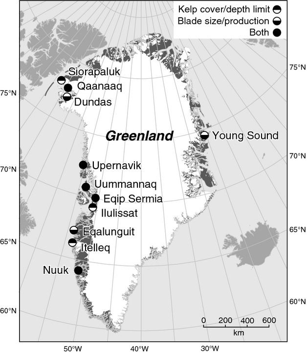
Map of sites along the Greenland coast with information from video surveys of the depth extension of the kelp belt (top of circle filled) and/or on production, size structure, nutrient content and reproductive status of kelp (S. latissima and/or S. longicruris) (bottom of circle filled).