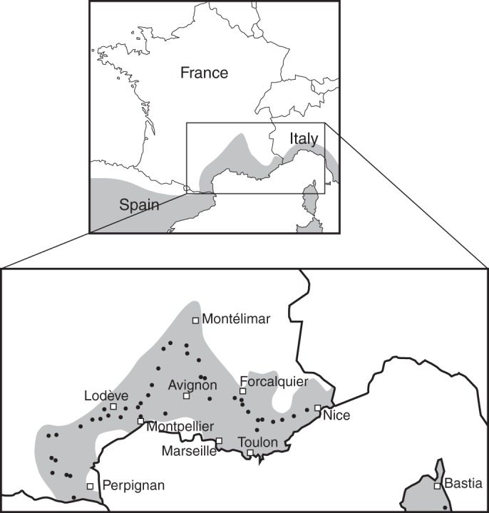
Fig. 1.

Geographical distribution of Quercus ilex (shaded) and locations of the 42 woodlands sampled (dots). The distribution area in the upper map is roughly adapted from Lumaret et al. (2002), while that in the lower map was based on data provided by the French National Institute of Geographical Information, IGN (Inventaire forestier national, 2011).
