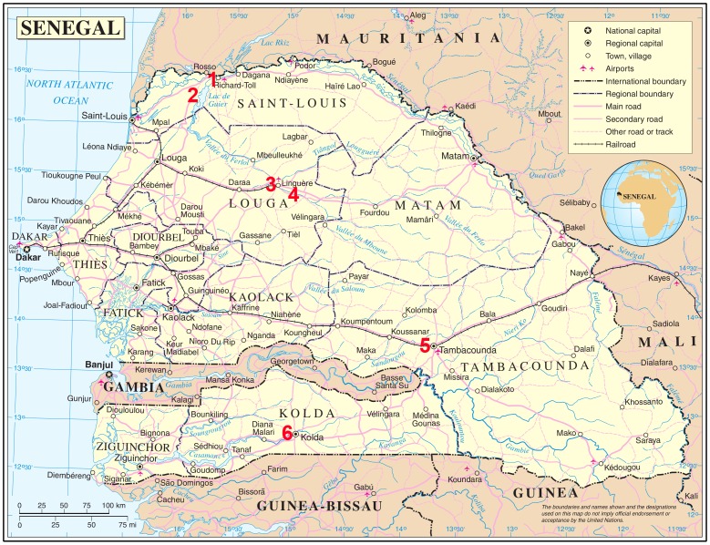
Figure 1. Map showing the location of the survey sites across Senegal.
The survey sties are numbered in red. GPS coordinates: 1. Richard Toll = 16°27′40.71″N, 15°41′15.29″W, 2. Nder = 16°15′33.50″N, 15°53′2.13″W, 3. Linguiere = 15°23′34.33″N, 15°6′55.87″W, 4. Barkedji = = 15°16′38.46″N, 14°51′55.48″W, 5. Tambacounda = 13°46′8.00″N, 13°40′2.00″W, 6. Kolda = 12°53′58.27″N, 14°56′39.37″W. The regions of Senegal are also shown on the map.

