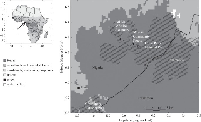
Figure 1.
Map of the study area. The arrow on the small inset map at the top left shows the location of the study region in Africa (black square with white edges). The main map shows the study region in more detail. Shadings represent different land covers, and most of the study region is covered by forest. Reserved areas as given by the World Database on Protected Areas [36] are shown by diagonal hatch. Boundaries given for CRNP appear uncertain as they extend into Cameroon. Locations of the study sites are given by the letters P and H, where P is a site where animals are well protected from hunting, and H where hunting occurs.

