
Fig 2.
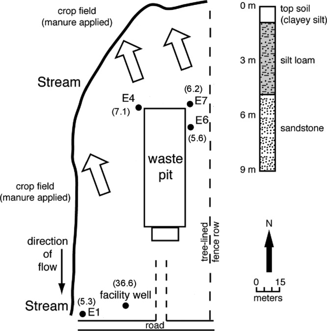
Map of groundwater wells at the site E pig production farm. The locations of groundwater wells are indicated by black circles, and the numbers in parentheses are well depths (m). An animal confinement building is situated above the waste lagoon. The direction of groundwater flow is indicated by large open arrows. Based on the direction of the groundwater flow and proximities to the waste lagoon, monitoring well E1 and the facility well served as background wells, where contamination was least anticipated. A corresponding stratigraphic column on the right indicates the characteristics of sand layers.