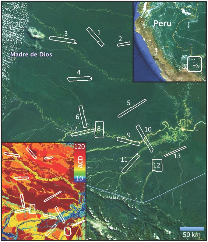
Figure 1. Thirteen CAO LiDAR mapping blocks were acquired in the southern Peruvian Amazon.
The upper inset shows location of the study region within Peru. The lower inset shows the LiDAR mapping blocks against a map of aboveground carbon density (ACD; Mg C ha−1), which integrates regional variation in geology, topography and canopy physiognomy [20].

