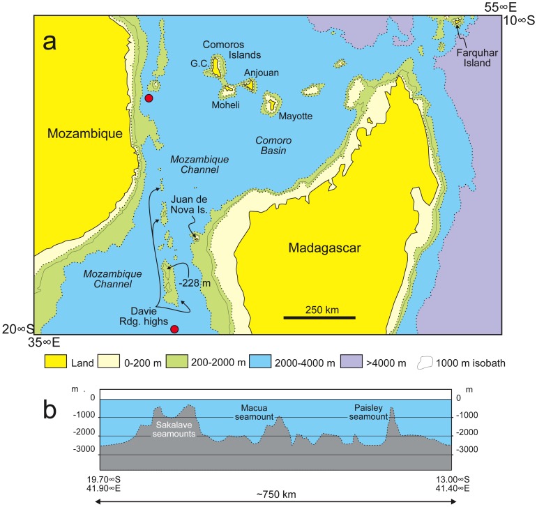
Figure 2. Simplified bathymetric map of the Mozambique Channel area.
The relative positions of Madagascar, Mozambique, and nearby islands are shown in (a), while (b) shows a bathymetric cross-section along the Davie Ridge. Red dots on (a) indicate the two ends of the cross-section. Even if elements of the ridge were subaerial, the deep, broad troughs widely separating the peaks would have posed formidable barriers to obligatorily terrestrial animals.

