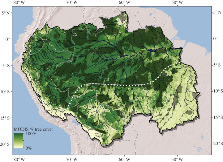
Figure 1.
Amazon Basin land cover. Fractional tree cover for the year 2010 [1] is shown in shades from light green (least) to medium green (most). Protected areas are shown in dark green (adapted from Soares-Filho et al. [2]). Areas of the basin south and east of the white-toothed line are in the arc of deforestation and are referred to in the text as south–southeastern (SSE) Amazon.

