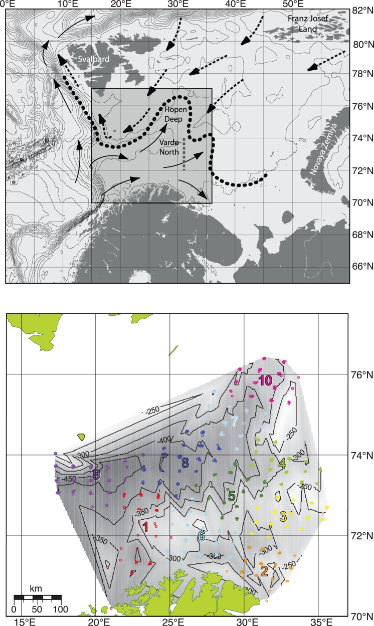
Figure 1. Main surface currents, bathymetry and sampling regions in the Barents Sea.
(a) Atlantic currents (–>) and Arctic currents (–>) and the mean position of where these water masses meet, at the depth of 20–100 m, the Polar Front (• • •) that most years follows the 200 m depth isoline that limits the study area in the North. The Vardø-North section located at 31°13′E. The study area is indicated by the grey square. In (b) bathymetry (shaded with isolines) based on information from all stations in 1992−2004 and stations (dots) with color of region (R1–R10). Stations shallower than 200 m have been excluded in all years.

