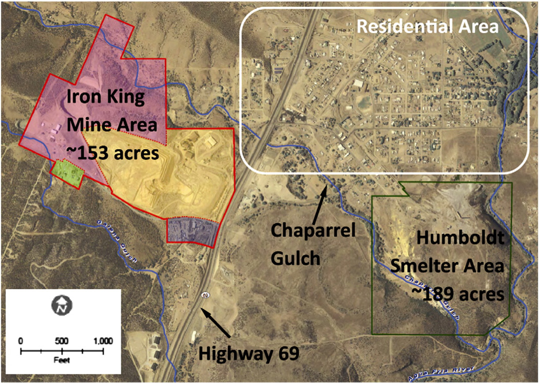
Fig. 1.
An aerial view of the Iron King Mine and Humboldt Smelter Superfund site, and the Dewey–Humboldt, Arizona residential area. Chaparral Gulch is a major waterway that runs through the Dewey–Humboldt area.
Aerial photo source: Yavapai County, GIS, 2007. Basemap source: ESRI Street Map, 2006. EA Engineering, Science, and Technology, Inc., 2010.

