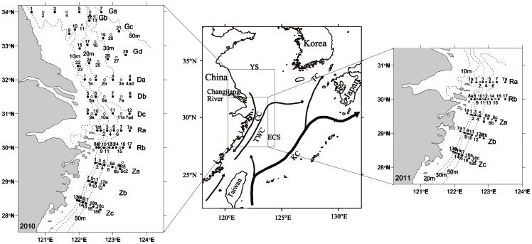
Figure 1. Sampling sites and Circulation pattern in the East China Sea (ECS) (modified from [4], [16]).
Left panel and right panel show the station locations in 2010 and 2011, respectively. Closed circle indicates comprehensive stations and open circle indicates hydrological stations, with labels above or below the station symbols, respectively. Transect labels are marked on the right of transects. Dot line indicates the isobath line. Middle panel, YS: Yellow Sea; KC: Kuroshio Current; TWC: Taiwan Warm Current; CC: Coastal Current (seasonal current with northward in summer and southward in winter); TC: Tsushima Current.

