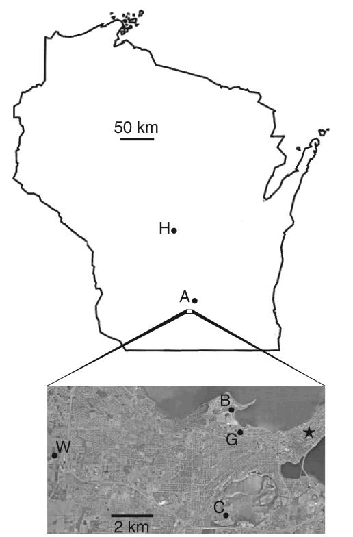
FIG. 1.
Map identifying the soil sampling locations used in this study. Designations are defined in Table 1. The star denotes the Wisconsin state capitol building in Madison. The aerial photograph was compiled from data provided by the U.S. Geological Survey.

