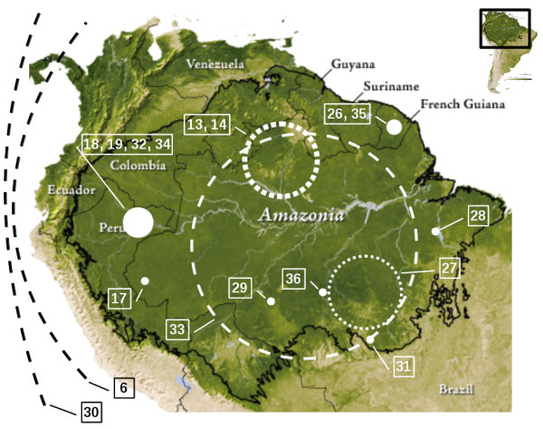
Figure 1.

Localization of the study areas. Points, dotted and dashed circles and lines schematically represent, respectively, local (study areas lower than 6,000 sq km), regional (from 22,500 [27] to 225,116 sq km [14]) and large scale studies. Point size and line width are proportional to the number of studies. Circle sizes do not strictly correspond to the study area surface. Base map source: NASA (http://earthobservatory.nasa.gov/Features/AmazonEVI/).
