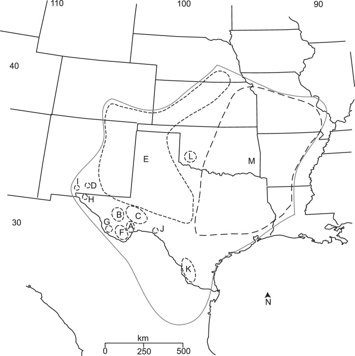
Figure 4. All COI TCS networks overlaid on a geographic map to illustrate network boundaries.
These networks are the same as in Figure 2: A: Black Gap, B: Balmorhea Springs/Davis Mts., C: Independence Creek, D: Oliver Lee, E: central Texas/eastern NM/CO/west KS/NE populations, F: Big Bend populations, G: Chinati, H: Hueco Tanks, I: Aguirre Springs, J: Seminole Canyon, K: Laredo/Falcon Lake, L: Wichita Mts., & M: northeastern populations.

