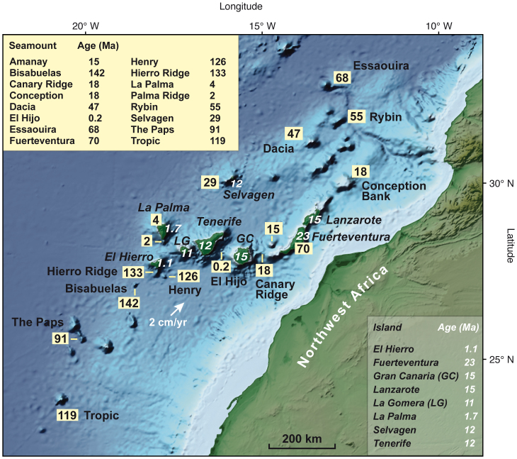
Figure 1. Topographic map of the NW African continental margin and age distribution in the Canary Island Seamount Province (CISP).
Numbers are the oldest ages determined for seamounts and islands in millions of years. Seamount ages from this study plus additional data for Henry29, La Palma14, Fuerteventura24,25,26, Amanay34, Selvagen, Conception, Dacia, Rybin, and Essaouira seamounts4,8. Oldest subaerial island ages (white) for Lanzarote and Fuerteventura12, Gran Canaria17, Tenerife10, La Gomera35, La Palma18, El Hierro13, and Selvagen8. Map base from NOAA (ETOPO1)36. Present plate motion vector from UNAVCO model (http://www.unavco.org).

