
Figure 5. Mantle upwelling and CISP follow the NW African continental margin.
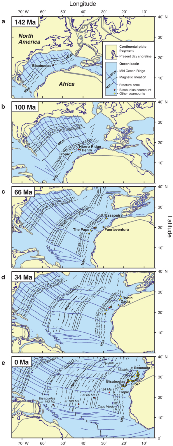
(a–e), Plate tectonic reconstructions and setting of CISP seamounts at 142 Ma (a), 100 Ma (b), 66 Ma (c, K-Pg boundary), 34 Ma (d), and Present (e). Maps created by the author with ODSN Advanced Plate Tectonic Reconstructions (http://www.odsn.de) The reconstructions show that the CISP started to form near palaeomagnetic anomaly M25 no later that 142 m.y. ago, when the North American and African continents were only 900 km apart (a). With the African Plate (continent plus new ocean crust) drifting primarily eastward, the MOR veering away to the NW and the North Central Atlantic opening up, more seamounts erupted at equal distance from the rifted NW African continental margin, scattered along palaeomagnetic anomaly M25 (b–c). At the latest from the K-Pg boundary (c) the outlines of the CISP have not changed significantly. Later seamounts fill up the space between Tropic and Essaouira (d). Figure (e) shows the present spatial distribution of all large seamounts in the CISP, including islands and unnamed and undated ones (see Fig. 1 for details). Future studies will show how many of these are actually much older, and should really be plotted in (a–d). The coordinates of Bisabuelas Seamount, as projected from (a–d) onto (e), illustrate the path taken by the African plate (central CISP range) from 142 Ma to Present. This is what a hotspot track should look like, if a deep fixed-plume mantle upwelling had ever existed beneath the central CISP at 142 Ma or later. Instead, mantle upwelling and CISP follow the African plate on its 3000 km journey to the E-NE, indicating that mantle convection is causally related and physically connected to the moving plate, its continental lithospheric roots respectively.