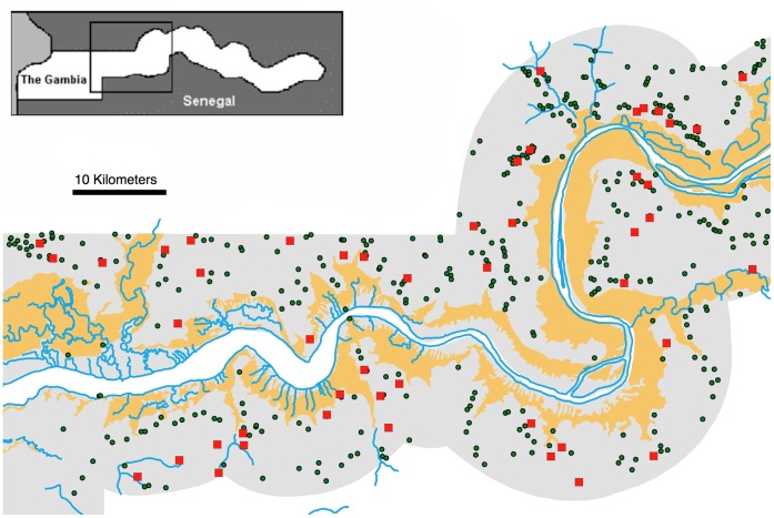
Figure 1. Map of the study area.
Central Gambia, showing study villages (red squares), other villages (green circles), main channel of The River Gambia and tributaries (blue lines), alluvial sediment (solid yellow). The Gambia nation is shaded grey, surrounded by Senegal in white. Inset: location of the study area in The Gambia.

