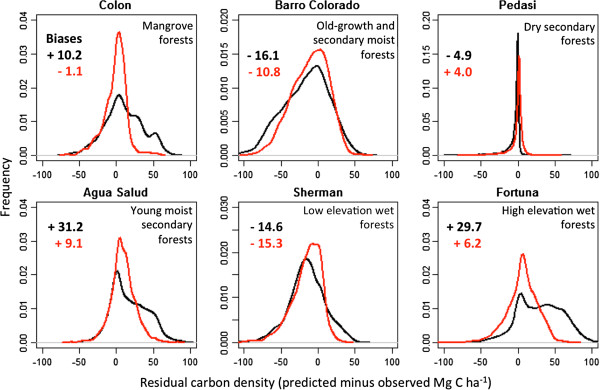
Figure 5.
LiDAR-based validation for six distinct ecoregions in Panama. For each region, more than 1,000 ha of LiDAR-estimated ACD data are compared to the stratification (black) and decision-tree (red) modeling results for national-scale ACD maps. Biases (national minus LiDAR-scale) are ≤ 15.3 Mg C ha-1 for all regions using the decision-tree based approach.

