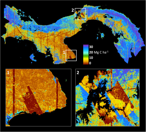
Figure 6.
Geospatially explicit uncertainty estimates at 1-ha resolution based on nested field-plot, airborne LiDAR, and decision-tree modeling methods. Note that direct LiDAR-observed areas (e.g., thin transects, and large polygons in insets 1 and 2) achieve extremely low uncertainties compared to areas upscaled to the national level using models.

