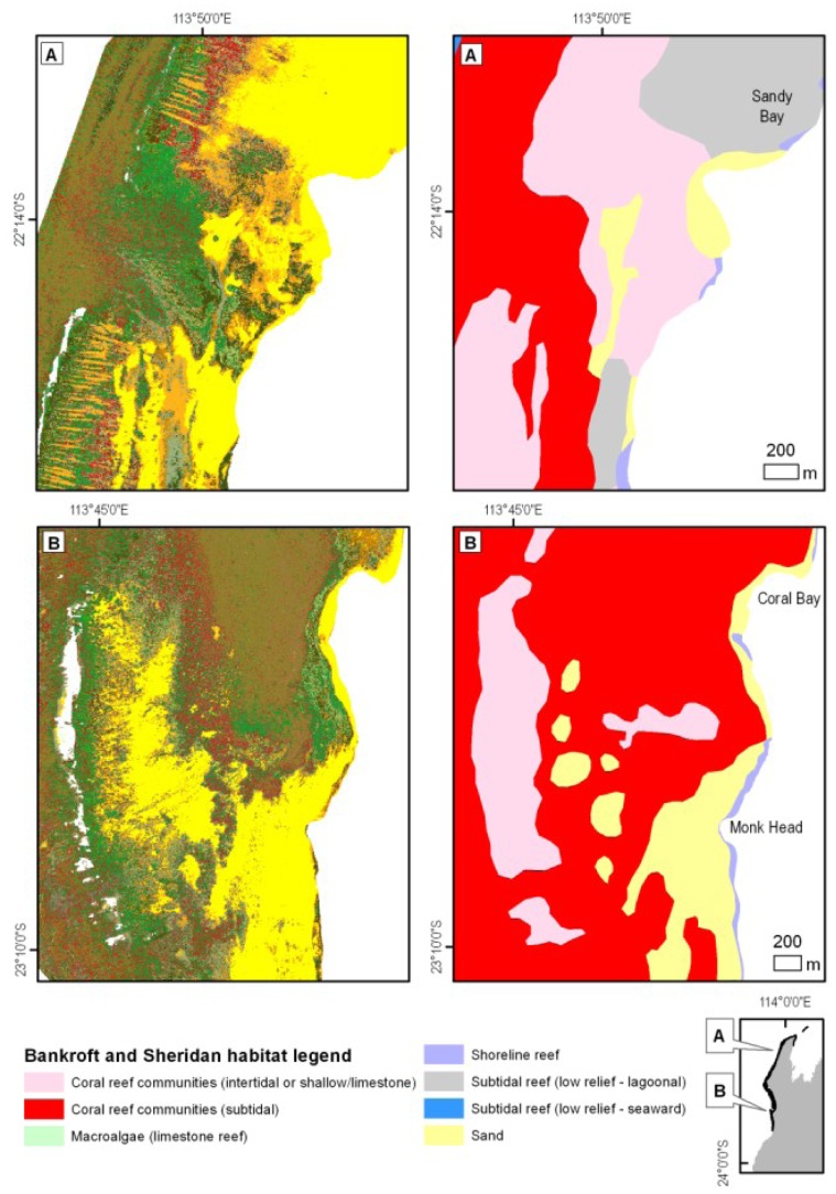
Figure 14. New hyperspectrally derived (left) and existing (Bancroft and Sheridan) [6], [7] (right) habitat maps for two selected areas in the northern (upper panels) and central regions (lower panels) of Ningaloo Reef.
(A) Reef channel west of Sandy Bay is characterized by a mix of macro-algae and pavement in the new map, contrasting with mostly coral cover in the existing map [6], [7]. Spur and groove patterns are evident on the reef flats north and south of the channel, a feature which is missed in the panel on the right. (B) Coral communities around Coral Bay with distinct transitions between coral and macro-algae dominated cover as well as clusters of bommies adjacent to the sandy lagoons which are overrepresented in area in the existing map. Legend for the maps in the left hand panels is the same as on Figure 7.

