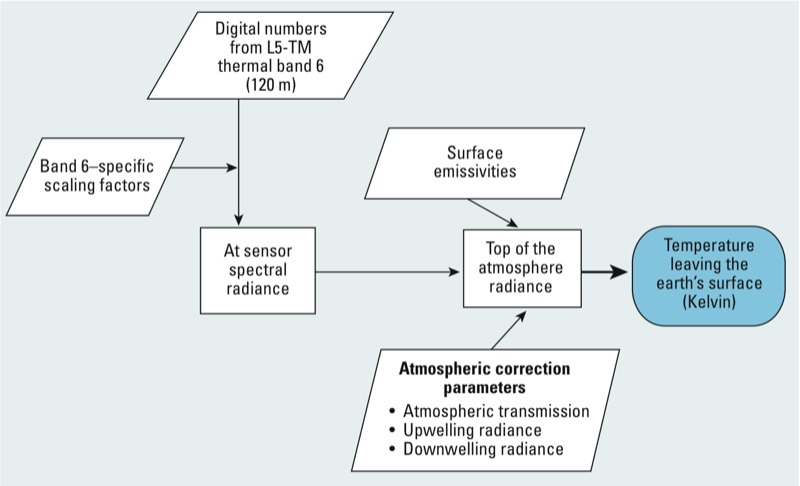
Figure 1.

The processing method for converting raw satellite images to land surface temperature. Parallelograms denote data inputs, squares denote calculations, and the shaded oval denotes the final value (temperature leaving Earth’s surface).

The processing method for converting raw satellite images to land surface temperature. Parallelograms denote data inputs, squares denote calculations, and the shaded oval denotes the final value (temperature leaving Earth’s surface).