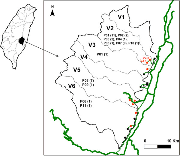
Figure 1.
Zhouxi Township map, showing the villages, tribes, genotypes, numbers of shigellosis cases, and road systems. The thicker green lines represent the Provincial Highway system, while the thin green line represents a road connecting the villages and tribes. Tribes with shigellosis during 2000-2007 are indicated in red, and otherwise indicated in black. The genotypes for the isolates and cases in each village are indicated and numbered in parenthesis.

