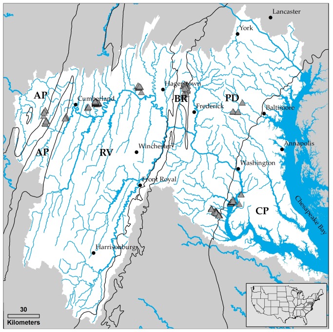
Figure 1. The study region covers the entire Potomac River watershed and adjacent watersheds along the Maryland–Pennsylvania boarder, and includes area in 5 distinct physiographic provinces (CP = Coastal plain; PD = Piedmont; BR = Blue ridge; RV = Ridge and valley; and AP = Appalachian plateau).
Triangles denote the 253 surveyed channel heads.

