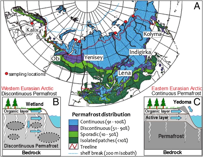
Fig. 1.
Eurasian Arctic transect and cartoon of hydrological mobilization of terrestrial carbon into rivers. (A) Map of the rivers (black lines) with permafrost distribution (modified from refs. 1 and 6) and sampling locations (red circles). (B) Illustration of the western Eurasian Arctic characterized by extensive moss-dominated wetlands underlain by discontinuous permafrost and ubiquitous deep groundwater conduits. (C) Illustration of eastern Eurasian Arctic characterized by a wide distribution of Yedoma ice complex, a thin seasonally thawing active layer, and thick continuous permafrost below. Blue arrows indicate hydrological transport of carbon from different physiogeographic regimes.

