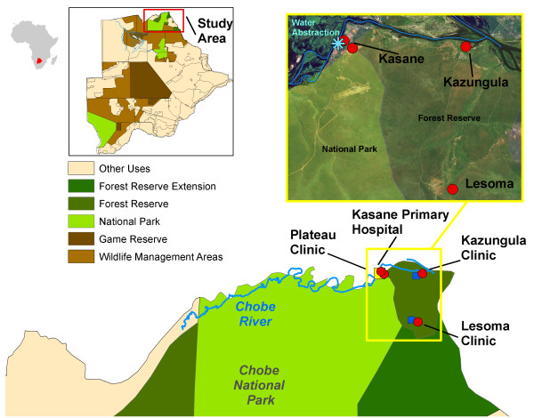
Figure 1.
Study area map. Map of villages reporting cases during diarrheal outbreaks (red dots) with the Kasane hospital (yellow square) and clinics (blue squares). Chobe District is a multi-land use area comprised of both protected (green areas) and unprotected areas (tan areas). The Chobe River (blue line) traverses both of these land types before abstraction for municipal use (iblue star).

