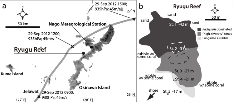
Figure 1. Map of Typhoon track and study stations.
(A) Map showing track of Typhoon 17 (Jelawat) around Okianwa-jima Island with position and (B) studied stations of Ryugu Reef. Data on the track indicates date, time, central atmospheric pressure and maximum wind speed at each “X” mark. In (B), dotted areas indicate positions of transects.

