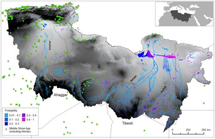
Figure 2. Simulated probability of surface water during the last interglacial.
This figure details Archaeological sites, and an annual probability that a location has surface water. The archaeological data are derived from a number of sources (including [42], [66], [67], [68]. The findspots are characterised by Aterian and Middle Stone Age artefacts such as bifacial foliates and stemmed Aterian points and/or typical ‘Mousterian’ points, side scrapers and Levallois technology. Most are represented by surface scatters but where stratified examples exist these can be shown by dating (OSL and U-series techniques) and geomorphological setting to belong within MIS 5e [41], [42].

