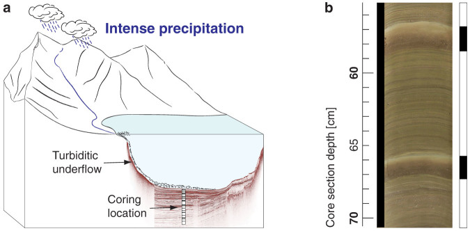
Figure 1. Flood-layer generation.

(a), Sketch illustrating erosion and mobilization of terrestrial material during intense precipitation in the catchment area. The sediment material is fed into the river drainage and upon entering the next downstream lake. The sediment-laden river water proceeds as turbiditic underflow to the deepest part of the lake basin, where the sediment load is deposited as characteristic flood-layer (illustration modified after13). (b), Core photograph with two flood-layers (indicated by black bars) from Lake Glattalp.
