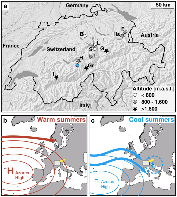
Figure 2. Alpine study sites.
(a), Location of studied lakes: B: Baldegg, F: Fälen, G: Glattalp, Gr: Grimsel, H: Hinterburg, Hs: Hinterer Schwendisee, I: Iffig, L: Lauerz, S: Seelisberg, T: Trüeb. Blue circle indicates the location of the Lower Grindelwald Glacier that was used for reconstruction of glacier-length change22. Relief data and map of Switzerland reproduced with permission of swisstopo/JA100119. (b–c), Schematic illustration of the meridional location and expansion of the Azores high-pressure system during warm and cool summers, controlling the pathways of westerly storm tracks (bold arrows) and the occurrence of Vb cyclones (dashed line). Varying expansion of the Hadley Cell leads to a northward-shift (southward-shift) and strengthening (weakening) of the Azores high-pressure system and of the westerly storm tracks, generating warm (cool) summers with less (more) intense precipitation in the Alps. White rectangle indicates the Alpine study area and yellow ellipse shows the location of the tree-ring-based summer temperature reconstruction used for comparison21.

