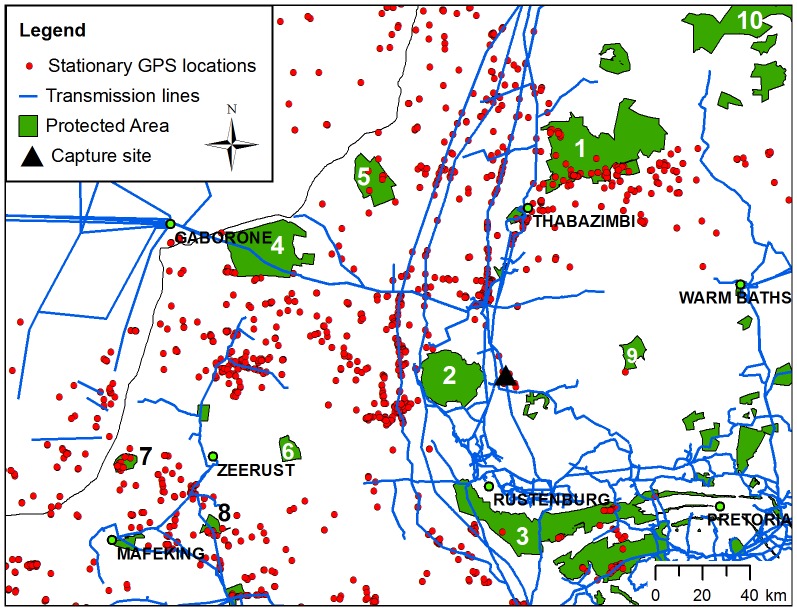
Figure 2. Stationary GPS locations in relation to protected areas and transmission power lines in the northern provinces of South Africa.
Stationary GPS locations (red circles) from nine Cape vultures tracked by GPS-GSM tracking units are shown with transmission power lines (blue lines) and protected areas (green ploygons [40], [41]). 1 = Marakele NP and Welgevonden NR; 2 = Pilanesberg NP; 3 = Magaliesberg NR; 4 = Madikwe GR; 5 = Atherstone NR; 6 = Marico-Bosveld NR; 7 = Botsalano GR; 8 = Oog van Malmanie GR; 9 = Borakalalo GR; 10 = Lapalala, Moepel et al. reserves. The capture site is indicated by a black triangle.

