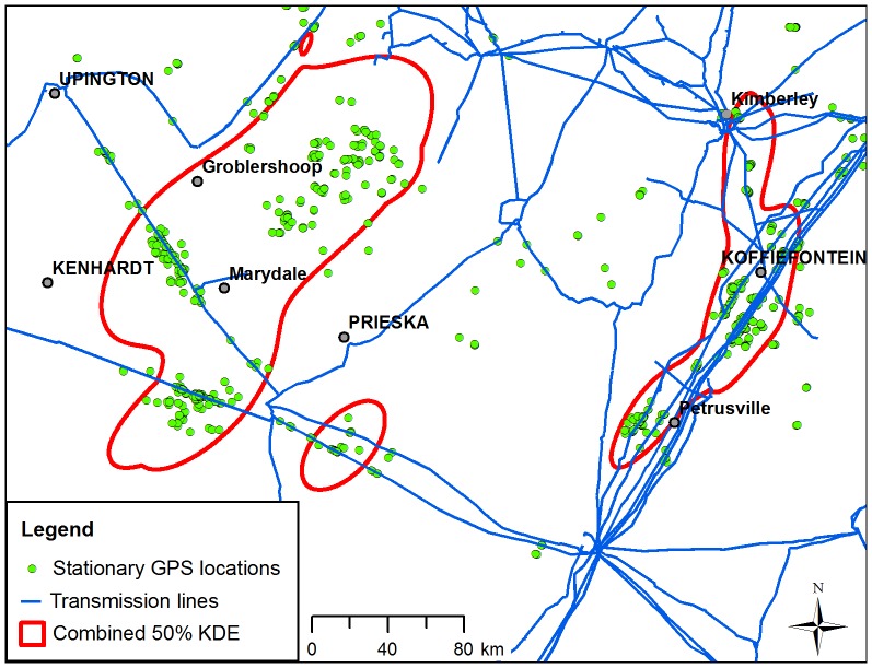
Figure 3. Stationary GPS locations and core areas in relation to transmission power lines in the Northern Cape Province, South Africa.
Stationary GPS locations (green circles) and merged 50% kernel density estimated (KDE) contours (hollow red polygons) from nine Cape vultures are shown in relation to transmission power lines (blue lines).

