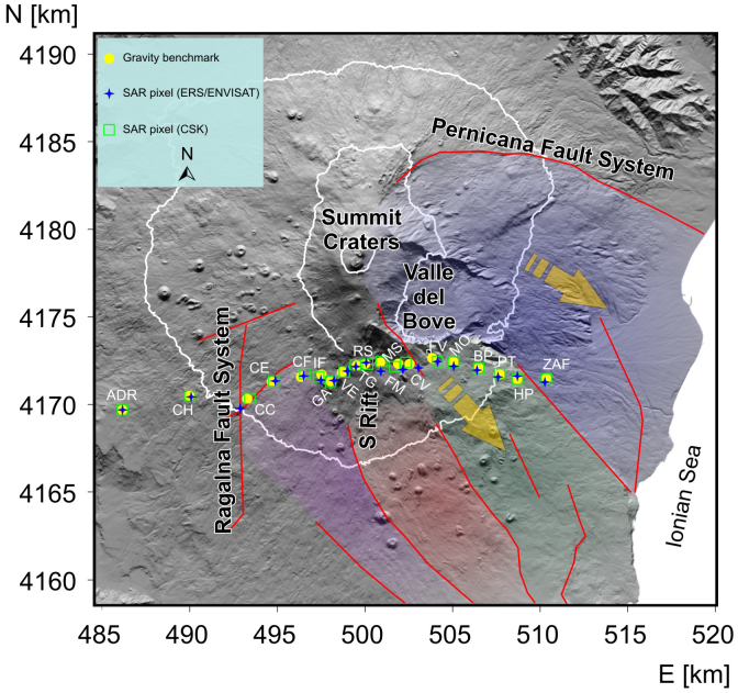
Figure 1. Etna volcano map with the location of the gravity stations running from Adrano (ADR) to Zafferana (ZAF) villages across the Rifugio Sapienza (RS).
The closest SAR pixels to the gravity stations are also reported for the ERS/ENVISAT and CSK time series. The major surface fault systems (red lines) border the main rigid blocks (colored shaded areas) of the eastern flank sliding21, which is delimited by the Ragalna fault to the SW and by the Pernicana fault to the NE. Geographical coordinates are expressed in UTM projection, zone 33N. All the figures in this paper were generated using a DEM owned by INGV.

