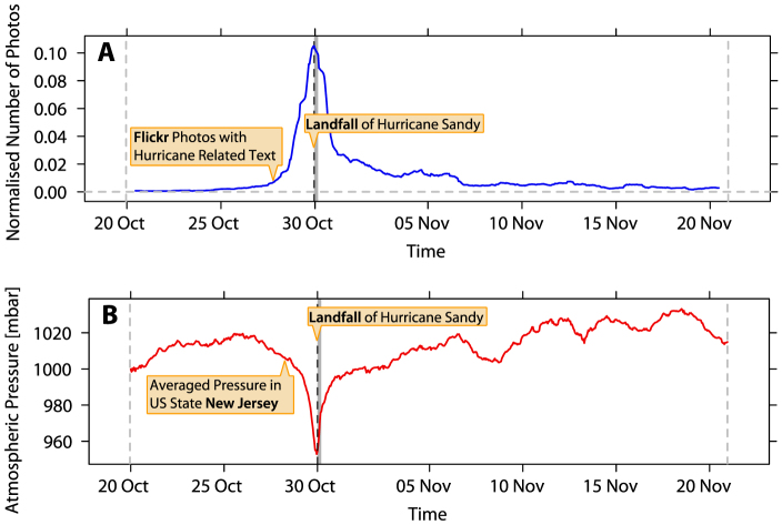
Figure 1. Hurricane Sandy related Flickr photos and atmospheric pressure in the US state New Jersey.
(A) We identify all photos taken between 20 October 2012 and 20 November 2012 which were subsequently uploaded to Flickr with any of the three terms Hurricane, Sandy and Hurricane Sandy in their tags, title or description text. Here we show the number of these Hurricane Sandy related Flickr photos normalized by the total number of photos taken and subsequently uploaded to Flickr. The data are analyzed at an hourly granularity. To eliminate daily periodicity in the hourly Flickr data, the data are transformed to represent the average value from a moving window spanning 24 hours (Δt = 24 hours). Date lines denote the beginning of a day in UTC. (B) The atmospheric pressure in New Jersey between 20 October 2012 and 20 November 2012. Atmospheric pressure data is compiled from average measurements from 62 stations in New Jersey that form part of the Automated Surface Observing System (ASOS). Again, the data are analyzed at an hourly granularity.

