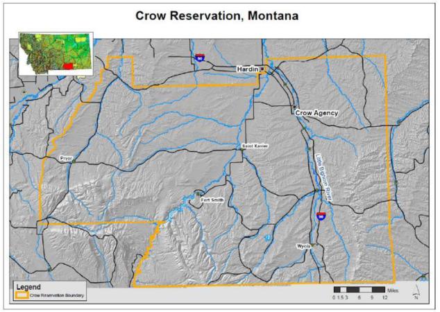
Figure I.
Map delineating Crow Reservation (in yellow) and proximity to Hardin, MT where meteorological data for the study was collected, 15 miles northwest of Crow Agency, MT. The Reservation is southeast of Billings, MT, with the Reservation’s southern border on the Wyoming-Montana State boundary. (Map prepared by Eggers; inset courtesy US Department of Agriculture)

