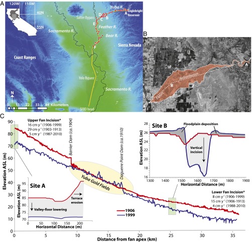
Fig. 1.
Yuba Fan. (A) HgT sediment sampling locations (red circles). The longitudinal transect along which mining sediment travels from the Sierra to the SFBD is shown in yellow. Sample sites A–F are described in the main text. Base: Shuttle Radar Topography Mission (SRTM) 1 arc-second. Yuba Fan delineation and hypothesized patterns of sediment redistribution and export (B) and longitudinal elevation profiles of the Yuba River channel bed, 1906 and 1999 (C). (Insets) Plots show cross-sectional change at sites A and B. *Fan incision rates for the early (10) and late 20th century are based on trends in water surface elevation. Supporting methodological description and data on slowing incision are provided in SI Methods and Table S1. ASL, above sea level.

