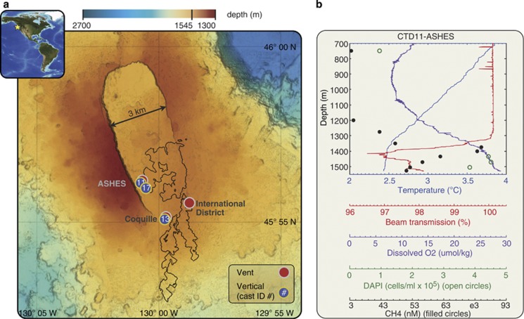
Figure 3.
(a) Axial Seamount, located in the northeastern Pacific Ocean on the Juan de Fuca Ridge 460 km west of the Oregon coast, is influenced by hot spot and mid-ocean ridge processes. The bathymetry represents 1-m resolution mapping conducted after the 2011 eruption, and the black outline describes the boundary of the 2011 lava flows (Caress et al., 2012). Vertical water column profiles were conducted directly over locations of known hydrothermal venting, including nos. 11 and 17 at the ASHES hydrothermal field and no. 13 at the Coquille vent. (b) Vertical profile of the bottom 800 m above the ASHES vent field. A background cast was performed 215 km east of Axial Seamount at 45.9°N × 127.9°W (Supplementary Figure 2).

