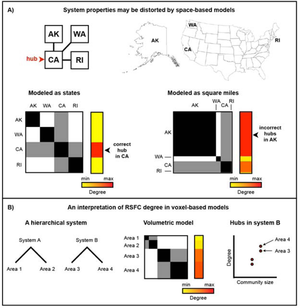
Figure 5. Volume-based models of brain organization may distort information processing properties of the brain.
A) Assume a spatially embedded economic system in which California (CA) is a hub of interstate commerce and Alaska (AK), Washington (WA), and Rhode Island (RI) play more peripheral roles. A graph in which nodes represent states correctly identifies CA as a hub. However, if states are represented by their areas (e.g., nodes of square miles), Alaska dominates the graph structure and is identified as the seat of hubs in the network simply by being the largest physical entity in the system. B) The parallels to RSFC are straightforward: areas contain voxels in proportion to their volume, and nodes within larger areas (and by extension members of larger systems) will tend be identified as hubs by degree simply because they are part of a large physical entity. Self-connections are allowed in the state graphs to emulate how voxels can and will correlate strongly to other voxels within the same area or system.

