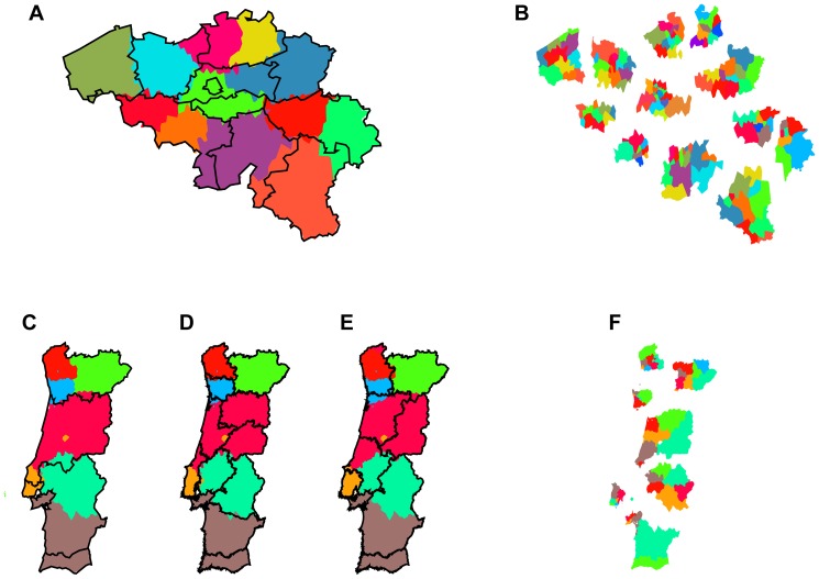
Figure 2. Partitioning of small European countries based on telephone call networks.
Left column: Community detection (first level) of mobile phone call networks of (A) Belgium, (C) Portugal. The black lines show the 11 and 5 administrative regions (NUTS2), respectively, the colored areas show the corresponding 12, 7 level 1 regions found by applying the modularity optimization algorithm on the country-wide phone call networks. Panel (D) shows the 11 historical regions of Portugal, which can explain some of the deviations from NUTS2. Panel (E) shows the poorly matching borders proposed in the failed referendum of 1998 to restructure administrative regions. All detected regions are cohesive although some of the distinct colors used may appear similar. Right column: Community detection (second level) within all network partitions from the first level, of (B) Belgium, (F) Portugal. For visual clarity here we present the second level communities grouped into first level communities in an exploded view. Colors of detected subregions only apply inside their respective level 1 partitions, again all detected subregions are cohesive although some of the distinct colors used may appear similar.

