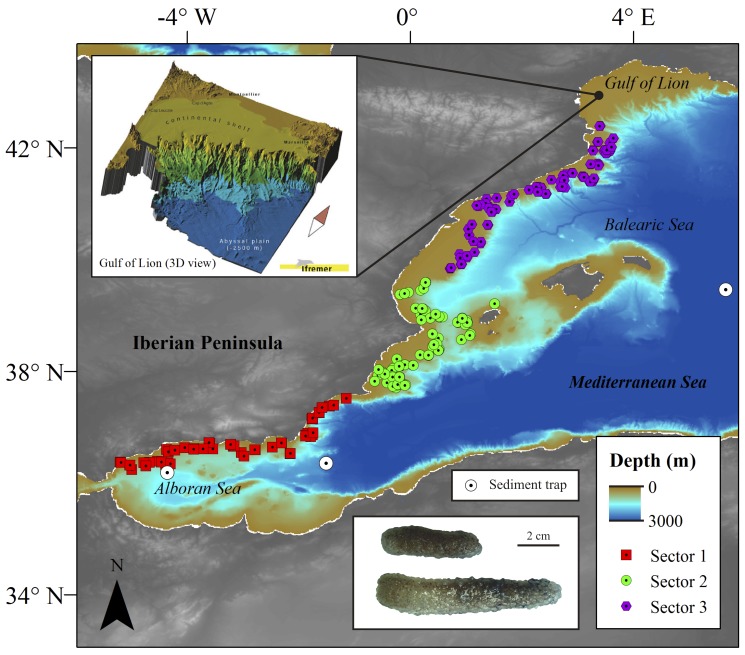
Figure 1. Study region in the western Mediterranean Sea continental margin.
The individual sampling sites (trawls) are presented in this map separated by sector to show the large scale of the depositions. Also included is a detailed 3D bathymetry display (copyright by Ifremer) of the canyon complexity in the north of sector 3 and a photo of freshly caught biomass. General bathymetry map data taken from the General Bathymetric Chart of the Oceans (GEBCO) digital atlas.

