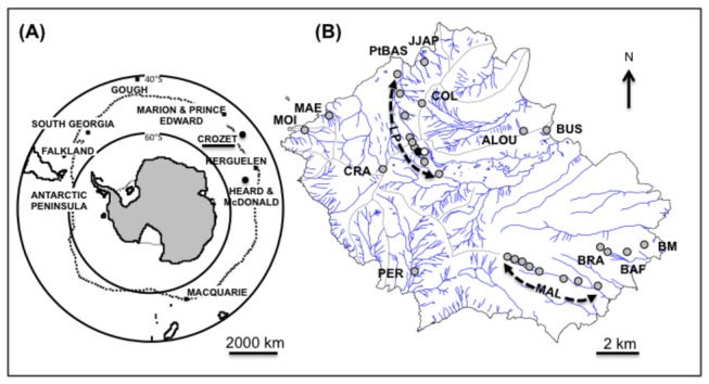
Figure 1. Sub-Antarctic Islands and study sites.

Location of Crozet archipelago within the sub-Antarctic region (A), geographical location of the 30 sites sampled on Possession Island that belongs to Crozet archipelago (B). The sites are represented by dots and dotted lines along two altitudinal gradients: Labourage-Pâturage (LP, n = 9 sites), Malpassée (MAL, n = 8 sites). Other abbreviations on the map: ALOU = Crête de l’Alouette, BAF = Base Alfred Faure, BM = Baie du Marin, BRA = Mont Branca (200 and 300 m), BUS = Baie Américaine, COL = Col, CRA = Mont des Cratères, JJAP = Jardin Japonais, MAE = Mare Aux Éléphants, MOI = Moines, PER = Pérouse, PtBAS = Pointe Basse. The black and the white dots indicate the two habitat types, M1 and M2 respectively, that were sampled at LP 550 m (see Fig. 4).
