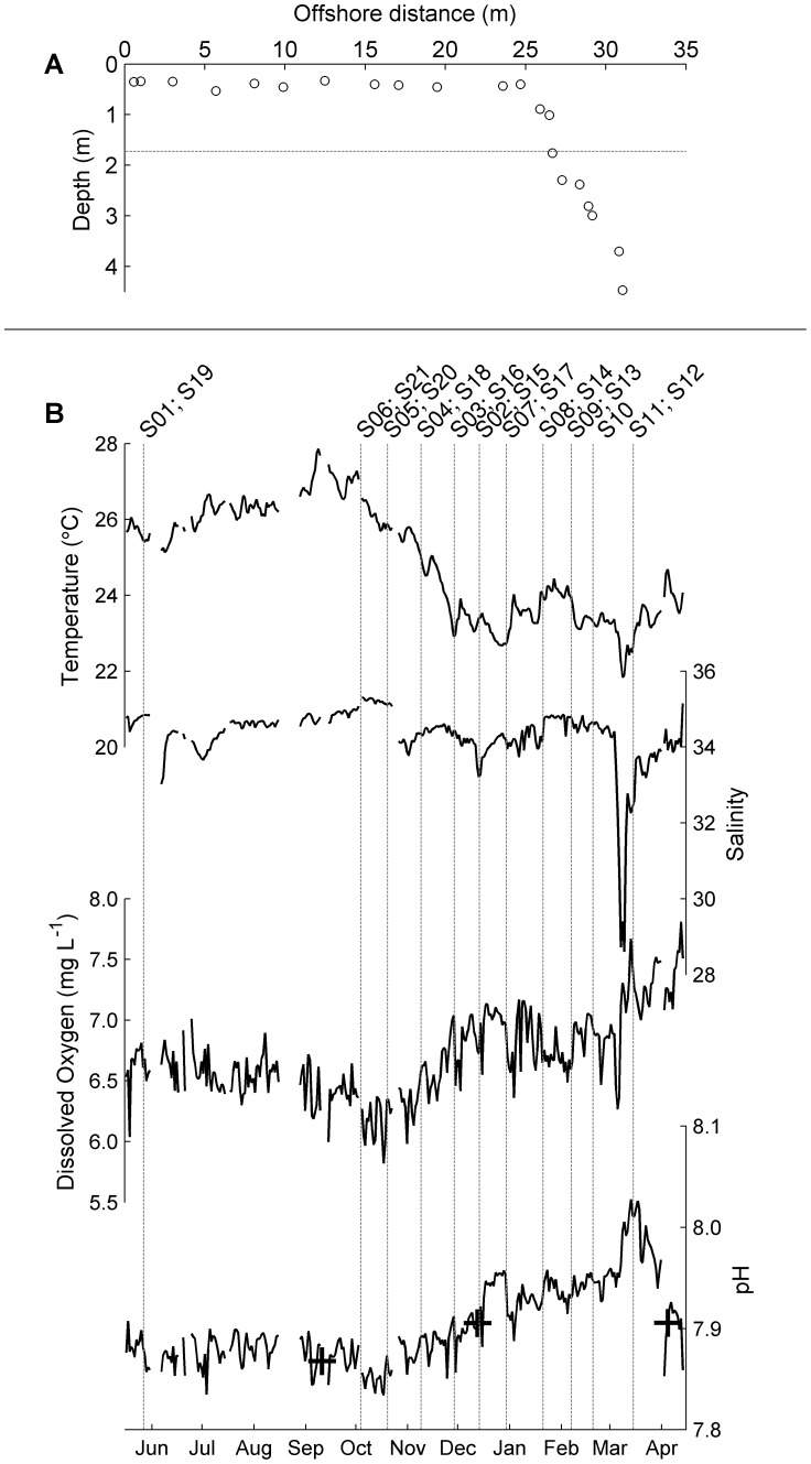
Figure 1. Timing and position of sensor deployments.
(A) Position of sites in the reef-flat to reef-slope transect on distance to shore-depth axes. Sites are numbered consecutively (S1–S21) from left to right. Horizontal dotted line marks the depth at which the long-term time series was located. (B) Time series plots of daily averaged temperature, salinity, dissolved oxygen concentration and pH from the long-term station. Vertical dotted lines mark the starts of the two-weeks deployments along the transect. Crosses on top of the pH time series correspond to in situ water measurements of pH. The names of the sites used in the deployments are shown on top.

