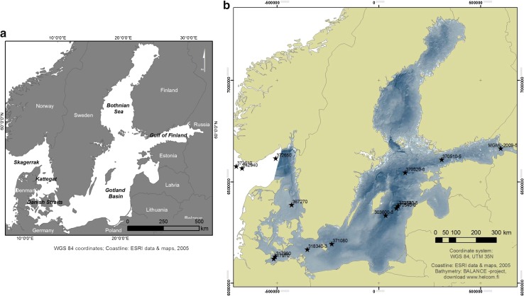
Fig. 1.
The Baltic Sea in Northern Europe. a Subregions of the Baltic Sea. b Key sites studied in the BONUS INFLOW project. Sediment core id numbers are shown in the figure. Detailed information on coring locations and water depths are shown in Table 1. The bathymetric map of the Baltic Sea is a product of the BALANCE “Baltic Sea Management – Nature Conservation and Sustainable Development of the Ecosystem through Spatial Planning” Interreg IIIB EU-project (modified from Kotilainen 2012)

