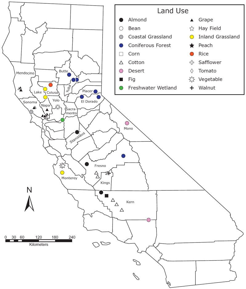
Figure 1.

Map indicating the location of the 17 Californian counties in which soils were sampled for phospholipid fatty acid (PLFA) analysis. Land-use types sampled in each county are described in Table 1. Different symbols are used to indicate different crop types sampled within annual and perennial agriculture. Given the close proximity of fields sampled in Yolo County, symbols for each crop type are obscured; as indicated in Table 1, two sites were sampled in Yolo County. At these sites, bean, corn, safflower and tomato fields were sampled. Additionally, the eastern-most coniferous forest symbols in El Dorado and Placer counties represent an average location for samples taken from 16 and 9 transects, respectively. Similarly, the symbols in Monterey County were taken from 37 sites, representing 5 vegetable fields, 7 hayfields and 25 inland grasslands (see Steenwerth et al., 2003, for a detailed map).
