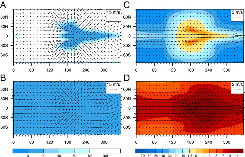
Fig. 1.
Spatial distributions of sea-ice fraction and surface air temperature. (Left) Sea-ice fraction (unit, %); (Right) surface air temperature (unit, °C); (Upper) 355 ppmv CO2; and (Lower) 200,000 ppmv CO2. In A and B, arrows indicate wind velocity at the lowest level of the atmospheric model (990 hPa), with a length scale of 15 m s−1. In C and D, arrows indicate ocean surface current velocity, with a length scale of 3 m s−1. Note that the color scale for surface air temperature is not linear. The substellar point is at the equator and 180° in longtitude.

