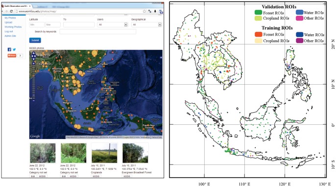
Figure 2. The spatial distribution of geo-referenced field photos in the study area, as hosted in (A) the Global Geo-referenced Field Photo Library.
The circle size indicates the number of the field photos. The figure also shows the search options, selected photos with GPS locations, and the link to extract the MODIS time series data. More information can be found in the data portal (www.eomf.ou.edu/photos). (B) The Regions of Interest (ROIs) used for the algorithm training and results validation, which were acquired by referring to the field photos shown in Fig. 2A and Google Earth.

