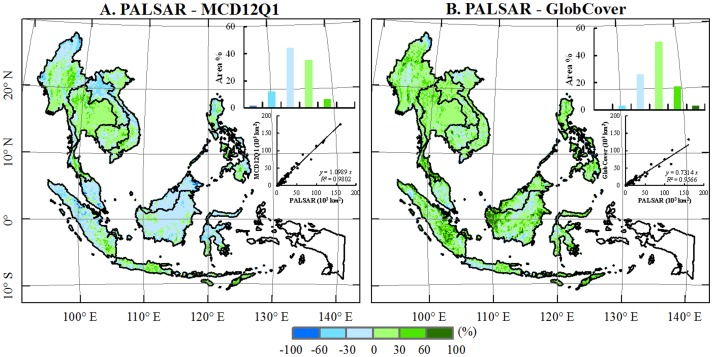
Figure 5. The comparison between the three fractional forest maps at a spatial resolution of 1.5-km by 1.5-km gridcell: (A) PALSAR – MCD12Q1 and (B) PALSAR – GlobCover.
The maps show the differences between two maps. The inset histograms show frequencies at various levels of difference between two maps. The scatter plots show the comparison in forest area at the sub-national level among PALSAR, MCD12Q1 and GlobCover in 2009. The data from the four provinces (Irian Jaya Barat, Maluku, Maluku Utara, and Papua) are excluded due to missing PALSAR data.

