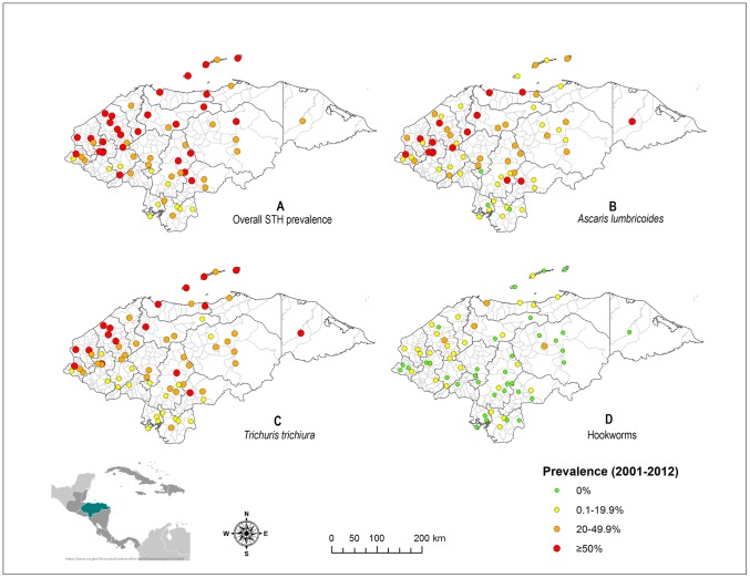
Figure 4. Mapping of observed overall and species-specific prevalence of soil-transmitted helminth infections in Honduras.
Data were pooled from 36 epidemiological studies (up to 108 datasets) done between 2001 and 2012. If multiple data were available for the same site (26%), a weighted average prevalence was calculated taking into account the sample size in each survey. Overall prevalence (map A) calculation was done from 96 datasets due to missing data. Prevalences of A. lumbricoides (map B), T. trichiura (map C), and hookworms (map D), were calculated based on all 108 datasets. Honduras is divided into 18 departments (boundaries defined by black lines on the maps) and 298 municipalities (boundaries defined by gray lines on the maps).

